Earthworks and Construction with Drones: Revolutionizing Project Management On-Site
By haadshaikh
In the world of construction, drones provide eye-opening data capture with analytics that saves project managers time and budget money in construction projects.
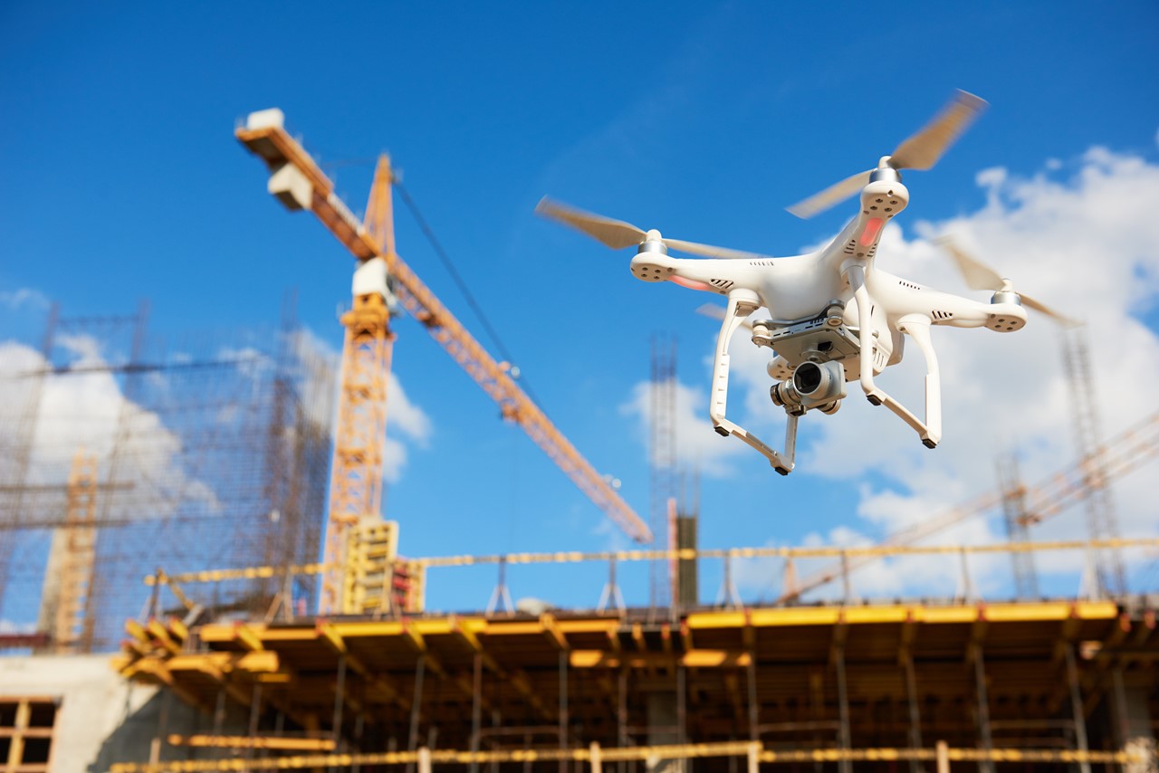
Drones – you’ve probably seen one flying around outdoors to capture aerial footage. It’s even more likely that you may have seen an onboard camera footage captured from a drone. In the world of construction, drones provide eye-opening data capture with analytics that saves project managers time and budget money in construction projects. Drones can do just that by enhancing workflow and instilling timely project completion with newer dimensions of progress tracking which is the goal of every successful project.
As technology continues to advance the world allows us to think of new progressive ideas on how to build infrastructure. Drones are becoming a powerful tool in construction and earthworks projects, as well as a tool for surveying large areas in a quick way. This article discusses the ways drones are being utilized in Earthworks, Construction and Surveying work sites. It might further help explain how Earthworks with Drone Surveys can help your business.
Pre-construction and Drone Surveys
Drones are a great way to get a bird’s eye view of a project before it has even started. They can be used to take photos, create elevation maps and do some basic surveying to get a good measurement of the work site area and the volumes to work with. Many construction companies are further using drones to help plan and monitor their projects.
For structures already present, drones can be used for property inspections, such as roofs, chimneys and other features that may be difficult to access by traditional means. The aerial images provide an effective way to document the condition of any structure or land parcel. You can use drones during site preparation stages such as grading, drainage and excavation work. The drone allows you to see areas that may require more attention or additional equipment before they start digging into your landscape or foundation wall.
Furthermore, it is important for construction companies to know where all utility lines are located before, they start working on a project so there are no surprises later on when it comes time for construction crews to dig in certain areas of your property where there may be buried pipes or cables. With drones you can quickly identify any underground utility lines before any mishap occurs which results in damaging underground infrastructure and added costs. This also proves to be nuisance for those utilizing those lines.
Benefits of Drones in Earthworks & Construction
Let’s cut to the chase – you want to know how drones can effectively save cash burns and get projects completed on time. If that really is your case, you’re in luck because this is for you. Here are six benefits of having a drone fleet in your team for a swift and efficient work flow.
1. Land Surveys and Geospatial (GIS) Maps
Construction projects utilize maps available to assess a work site. A big problem for some of them, consulting maps is very expensive. It is however essential for effective planning of large, complex work sites. At times, the maps used are usually old and may be outdated – there may be a new structure around which may be missing in your existing map.
Drones may drastically reduce the time required assessing a site’s topography due to their capacity to map large areas of land. This aids in keeping the project on track and under budget, as well as ensuring correctness before it begins. This data may be used to assess feasibility and aid with the design of the structure for which the earthworks activity is being carried out.
Additionally, the high-resolution photographs obtained by drones may be transformed into 3D models (on software), allowing the construction crews to pinpoint issues during pre-construction and discover scope errors, thus saving time and money.
For infrastructure development, the maps and models can even be imported to Autodesk Civil 3D for civil engineers and surveyors to design, draught and manage the site development.
Drone Surveys don’t take very long. A typical 25-acre land can be mapped in a time of 30 minutes. Saving up to 20x cost of creating topographical maps from scratch. Teams can use some licensed and free software to stitch maps into models and even analyze data including work site areas, volumes, stockpiles and structures.
2. Tracking Equipment at the Worksite
Project Managers on large projects have to pull their hair all day long figuring out where a specific equipment is located at a job site. This may have been optimized with modern software which tells you where a certain excavator ‘should be’ located at a certain time. This also means long never-ending spreadsheets which, let’s face it, is a total nightmare.
With a drone, the same manager can conduct his regular flyovers and assess the area from a bird’s eye.
There are also commercially off-the-shelf equipment tracking hardware that can be placed on top of earthmoving equipment to track them live and on the map which was previously surveyed with a drone. We recommend you check out Propeller Aero’s Dirtmate for live equipment tracking at the work site. The technology allows users to gain powerful worksite data and insights on where a vehicle has been previously, how much time it took for a task and further view, understand, share and use all of this data – the answer to all your project management questions.
3. Remote Monitoring and Progress Reporting
You may have figured already that drones can capture and display data in real-time. With land surveys taking less than 30 minutes to complete, project managers can survey construction sites on a daily basis. This allows for data to be shared with peers and superiors who do not have to be at the site to get up to date with progress. The daily updates and stunning visuals of each day’s progress can be shared with time lapses spanning weeks or months. Also, this data can be stored and future use and can always be reviewed on how things were done in the past. This trail of documentation can be accessed any time.
Land surveys also provide cm level GIS precision so the operators can measure the width or height of a wall / tower without having to physically measure it with a measuring tape. Design teams, engineers and construction managers can use this data (and more) to follow projects and point out any mistakes that may have occurred during construction – this we know happens a lot in cases of money against time.
4. Stockpile Analysis
Ask any drone expert, drones can accurately take stockpile measurements and calculate the amount of material present. This data allows for engineers to plot volumes of the earth that requires moving. This also gives project managers some good information on the amount of material available and the resources required to move it. This builds a better picture and allows documentation throughout the construction project thus saving costs and times through the project span.
Stockpile is measured by conducting a surveying exercise and then building control volumes in the software (which presents the model in 3D space) to accurately depict the volume estimations of the material present. With the material density known, the mass of the material can also be depicted.
We recommend this blog by Propeller Aero on Stockpiles Measurements and Tracking Volumes.
5. Surveillance, Security and Safety of the Job Site
Construction material and equipment (including vehicles) get stolen every year, let’s face it – this even happens in Pakistan. As a manager, equipment security is imminent and there are autonomous airborne surveillance solutions available where surveillance cameras cannot be placed or ‘hooked up’.
A drone operator can do quick, scheduled flyovers (even in the night) to assess if all equipment is in place where it belongs. This can help prevent theft, damage and identify trespassers.
Tethered drones are a new concept being utilized for round-the-clock surveillance and have been seen in construction surveillance and progress monitoring. Tethered drones like the Elistair Orion 2, or the HUMMER Tethered Drone by Integrated Dynamics (a drone manufacturer in Pakistan), can be used for perimeter surveillance for 24 hours or beyond, i.e., as long as it’s plugged into the grid or a generator. Tethered drones are ‘tethered’ by a power cable connected to a power outlet and can be operated to a height of up to 100 meters (depending on the manufacturer).
6. Inspections and Cinematography
Drones can be used for inspecting towers and high unstable platforms which are common in construction. A number of worker fatalities are reported annually in Pakistan due to falls from construction sites. Rather than taking manual measurements, drones can replace workers in such situations to mitigate the risks associated. The data can also be recorded and reviewed with project managers which has a more reliability factor than what the construction worker who measured a wall to be ‘12.5 feet’.
At the construction site, drones equipped with thermal imaging payloads can detect heat leaks, electrical issues and cold spots. A data at that level will surely put an impression on the customer, improving relationships in the long run
The Future of Drones in Construction and Earthworks
By now you may have guessed the potential drones have but there is more from where that came from. The technology has been very innovative in assisting and improving processes. A use case of using heavy-lift drones would be to transport raw material from the ground to the top of a 20-story building, no need to set up elevators with diesel motors in this case. The technology is advancing even further. However, current capabilities of drones have immense potential in saving time, cutting costs, minimizing risks and improving labor safety. If this technology is adopted and implemented on a large scale, this will surely pave way to greater construction cycles and a better industry for construction and earthworks.
1 Comment
Have something to add to this blog? Leave a comment below.